Our Services
Geospatial & Asset Management
At Waggoner, we harness the power of geospatial data to help communities and businesses manage infrastructure and assets with clarity and confidence. From mapping underground utilities to tracking the condition of public assets, we empower clients with real-time insights for smarter decisions. Our team supports local governments, utility providers and private industries with tailored GIS solutions, integrating them seamlessly into planning, design and construction workflows.
Whether it’s boosting efficiency, improving service delivery, or supporting long-term growth, our GIS and asset management services deliver measurable value at every stage.

- Statewide and Regional Mapping
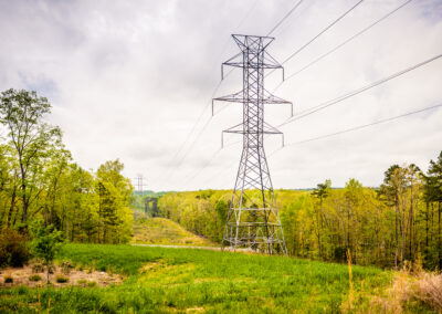
- Utility Infrastructure Modeling and Analysis
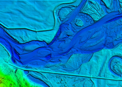
- Digital Terrain and Elevation Modeling
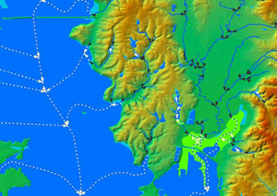
- Land Use Mapping and Spatial Analysis
- Asset Inventory and Lifecycle Management
- Hazard Risk and Vulnerability Mapping
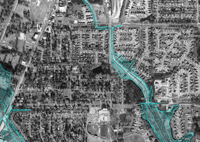
- Post-Construction Geospatial Data Capture
- Trimble Cityworks® Business Partner
- Esri® Bronze Business Partner
- Esri® Developer Network Member